Teacher Notes in Yellow
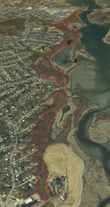
Note that the map below was created using Google Earth. There is a nice feature where you can exaggerate elevation; this allows you to see the topography in more relief.
Another wonderful place to view an esker is on Thompson Island in Boston Harbor. It is quite difficult to find intact eskers these days!
Great Esker Park in Weymouth lies on top of an esker. An esker is formed by a stream or river in a tunnel underneath a glacier. It is made up of the sediments dropped by that stream or river. When the glacier retreats, the deposits remain, exposing a long, winding hill where the stream or river used to be. Eskers are great sources of gravel and sand (used in construction), and consequently most eskers have been stripped away for these materials. Great Esker Park is one of the few remaining places in the Boston area where you can see a relatively intact esker.
Can you identify the esker in the picture below. Describe the shape of the esker. Why do you think it has this shape?
An aerial picture of Great Esker Park. (Elevation is exaggerated.) From Google Earth.
|

Pictures taken, along the esker, from location 2 (map on left):

Pictures taken from location 3 (map on left):
