Boston's South End is mostly filled land (like the Back Bay neighborhood). This filling occured in stages, and at each stage new problems and challenges arose. The story of filling the South End shows the connection between development and water use.
Several projects occured during the 1800's that stressed out the water system and led to flooding and pollution. Each of these projects was designed to modernize and expand the city, but together they created new unanticipated problems that then had to be solved.
The Mill Dam Project and the South End
The "Mill Dam Project" was planned as a way to harness the power of the tides to power many mills, thus turning Boston into a thriving mill town. Unfortunately, the project was a dismal failure. In addition to not producing the expected power for the number of mills predicted (only 3 were ever in operation at one time; 81 were predicted!), the damming of Back Bay prevented the flushing of sewage and trash out to sea. Foul odors and increased mosquitos (and other pests) were the ultimate product of the Mill Dam Project! The dam was built in 1821.
Boston was facing population pressures in the mid-1800's, so there was a great deal of popular support for the idea of creating land for more housing. In addition, many wealthier Bostonians were leaving the city in the mid-1800's; by creating fancy new neighborhoods, the leaders of Boston hoped to keep these folks in the city.

Photograph from the State House, towards Back Bay, showing the Mill Dam. When do you think this photo was taken? What clues did you use to determine the age of the photo?

Map of the Back Bay in 1836, showing the Mill Dam crossing the top of the Bay. You can see the Bay Village and the South End on the map. By 1836, much of the South End had been filled in.
A Solution Creates a Problem
The first part of the South End to be filled in was the area known as Bay Village. This area was filled in during the 1820's, after the Mill Dam had been created. In order to make the filling of land easier, a dike was built across the southern part of Bay Bay. For the first years of Bay Village, their sewers drained into the part of Back Bay that was always kept lower than the high tide level (this was known as the "Receiving Basin").
Shortly after, in the 1830's, there was an expansion of railroads into the city. Three separate companies built railroads into the city, and two of these lines crossed, right in the middle of the Back Bay. Embankments were built under the railroad lines, which further prevented the flow of water in and out of the bay.
By the 1860's, filling had begun in the rest of Back Bay (the Mill Dam Project owners had decided that filling in and selling the land was more profitable). Unfortunately for those who dwelled in Bay Village and the rest of the South End, this put pressure on their wastewater drainage systems. The problem was that their houses were built at sea level and drained into the Receiving Basin, whose level was always below the high tide line. With Back Bay being filled in, the sewers from the South End were rerouted, now draining into normal tidal areas. As a result, sewage would not drain during high tide, especially during storms!
This problem was made worse by the fact that in 1848 water began being piped in to houses, and as a result increased wastewater was put into the sewers.

This picture represents the shoreline after the initial filling of Bay Village and how sewage was piped out to Back Bay.
At low tide, the sewage drained fine.

Successful operation of the Mill Dam Project required keeping the high tide level artificially low in the location where Bay Village dumped its sewage.
This allowed the sewage to drain even at high tide.

Back Bay became more filled in and sewer lines were extended to where high and low tide were at normal levels.
This caused the sewage to back up at high tide because it could no longer drain.
Challenge Activity:
Build a simple working model that illustrates the problems with drainage in Bay Village as Back Bay began to be filled. Show successful drainage at low tide and backup at high tide. Build your model using the following materials:
- dishpan
- sand
- water
- food coloring
- straws
- tape
- eye dropper
- beaker/cup to hold water.
Another Solution Needed
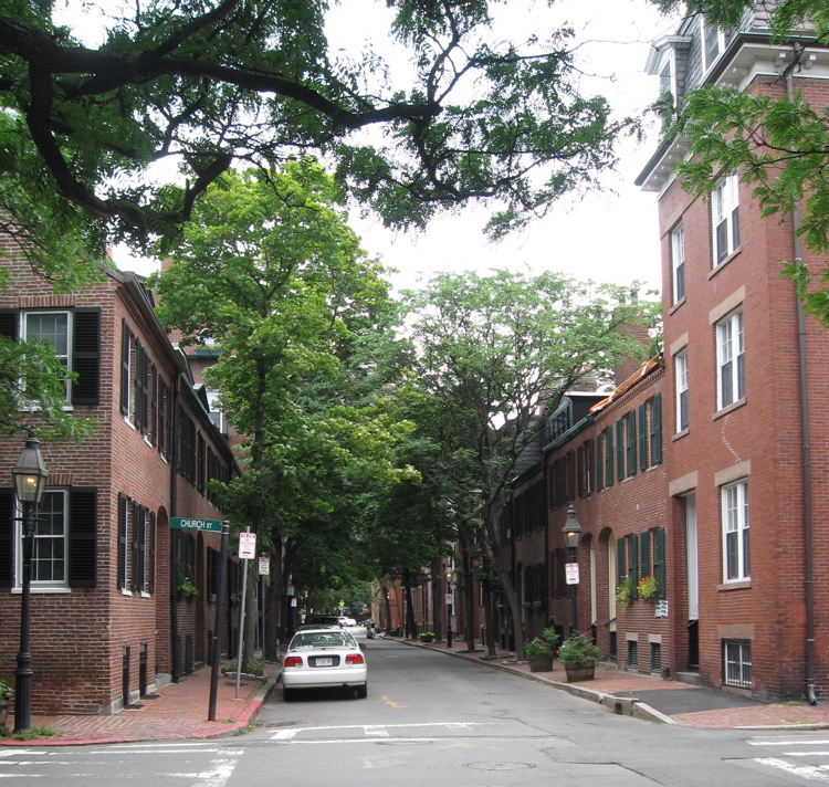
Among possible solutions to this problem were: (a) filling up cellars, (b) installing pumps to pump out the waste, or (c) raise up the land level, first by raising up the buildings. Option (c) was the route the city chose. This involved a massive project to lift entire city blocks of buildings, filling in below the raised buildings, and setting them back down, now on higher ground. Walking around Bay Village one can see examples of houses that were raised (and some that were not!).
The rest of the South End faced the same problem late in the 1880's, but it was not quite as bad. This time the city built a large pumping station to help remove the waste. This pumping station operates to this day.

Image from 1868 showing the raising of houses in Bay Village
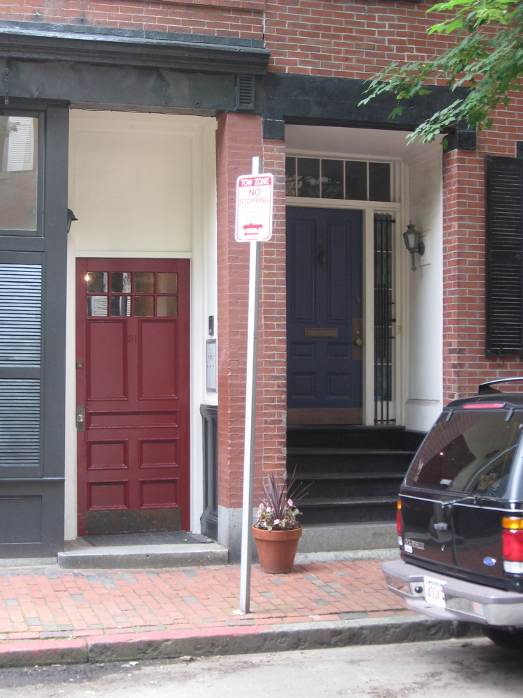
Of these two side-by-side houses, only one was raised. Can you tell which one??

An example of a raised Bay Village House

The filling in of South End land occured in two stages - one in the 1840's, and one in the 1860's. The house on the right is much older, and is a more modest style. The more recently built house was built later and is a more ornate style. Note that the older was built before issues of water drainage were known. Therefore, it is lower - probably right at sea level.
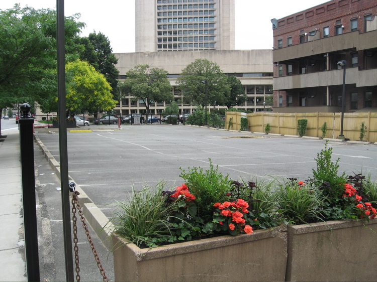
The Fitz Inn parking lot at the edge of Gravelly Point in the South End. Notice that the parking lot is anything but level. The Fitz Inn Hotel used to stand here, but the ground settled so much that the building had to be torn down. This part of the South End was actually a marsh, and was one of the last areas to be filled in. The marsh land was so soft, that even with added fill the ground continues to experience issues of settling.

Maps of the Back Bay from 1861 and 1871. You can see the progression of landfill and streets and buildings througout that decade.

By 1888, Back Bay is almost entirely filled in, with the exception of the Fenway area.